Our route from Kingman, AZ to the Wildrose Campground at Death Valley National Park is HERE.
We arrived in Kingman late yesterday, retired to our room and left Kingman without paying much attention to the city. Out of fairness to Kingman, I guess I should say something about the county seat of Mohave County. Kingman, population=20268, was founded in 1882 along the newly-constructed route of the Atlantic and Pacific Railroad. Pamela Anderson did a Playboy episode here, a Soprano's episode was done here and most importantly, Kingman lay along Route 66. Enough with Kingman.
We left Kingman around 8am and headed North towards the Hoover Dam. We had talked about stopping at the Grand Canyon Skywalk, a platform with a clear floor that extends over the South rim of the Grand Canyon built on property owned by the Hualapai Tribe. The cost was a bit steep, $80/person, but the real deal killer for me was that any photography, whether by camera or cellphone, is prohibited. If you wanted a photo, you'd have to buy one from the gift shop. Quel scam. I was disappointed to not go, but I'd have been really furious at having been ripped off if we went.
The 70 miles from Kingman to the Hoover Dam was through Arizona desert, stark, but beautiful in its own way. For the second time, in the middle of what should have been nowhere, another Really Good Fresh Jerkyshack popped up…we stopped by, but it was closed.
I felt privileged to have seen first hand three of Gus's locations.
I was excited about returning to the Hoover Dam after a previous visit >10 years ago. Lani was pretty disinterested, but as we approached the vicinity of the dam, she was wowed by the Hoover Dam Bypass immediately overhead.
Approaching Hoover Dam from the West, you suddenly emerge under the the Mike O'Callaghan – Pat Tillman Memorial Bridge, also known as the Hoover Dam Bypass, the first concrete-steel composite arch bridge built in the United States, and incorporates the longest concrete arch in the Western Hemisphere. Lani's jaw dropped with a long "Wow". Michael O'Callaghan was a former Nevada governor and decorated Korean War veteran. Pat Tillman was a former Arizona State University Arizona Cardinals football player who turned his back on a multi-million dollar contract to join the service, only to die in Afghanistan in a notorious friendly-fire incident.
We didn’t do the full tour, but walked across the dam, taking in the structure and the man-made lake behind the dam. If you’ve never been, it is way cool and worth going out of your way.
Lani stops to read the inscription on the monument approaching the bridge.
100 men died during the construction of Hoover Dam which took place between 1931-1935
Following 9/11, through traffic over the bridge came to a halt. About 1,000,000 visitors take the official tour (which is the only way to see the inside of the dam and the hydroelectric rotors.)
Two Florida tourists visiting the Hoover Dam.
As you walk across Hoover Dam, you move between time zones.
The daming of the Colorado River at the Hoover Dam created Lake Mead, the largest reservoir in the United States. Lake Mead draws a majority of its water from snow melt in the Colorado, Wyoming, and Utah Rocky Mountains. Lake Mead offers many types of recreation to locals and visitors. Boating is the most popular. Additional activities include fishing, water skiing, swimming and sunbathing.
This panorama, stitched from 5 separate images, is 15' long. Let me know if you want one. Or three.
Crossing the river, you move an hour into the past.
Leaving the Hoover Dam, we had to wait for a giant flat bed with a wing to negotiate a turn.
We saw many big rigs on the highways hauling some crazy large objects, many of them looking military.
Heading towards Death Valley, we passed through Henderson, NV where Lani had already identified a used book store, Book Boutique. I chatted with the owner, Shireen, while Lani searched the shelf of old books.
Lani found a copy of Shakespeare'sMerchantof Venice published in 1871 priced at $15. There was an inscription on the inside cover in ink, dated 1874 from someone who lived in Boston.
Lani was pretty excited. The book was in pretty good condition, sporting that old book smell.
The last Shakespeare I read was the 2nd semester of college, Measure for Measure.
Doing some internet research, Lani may have overpaid.
We turned towards Death Valley, stopping in Pahrump, Nevada for lunch. Pahrump, 60 miles from Las Vegas, has experienced exponential growth over the past 40 years. Originally inhabited by the Shoshone's, it was named after the original indigenous name Pah-Rimpi, or "Water Rock," so named because of the abundant artesian wells in the valley. Yelp pointed us to a Thai restaurant.
My Thai was located in a strip mall, right next to the gas pumps. We were dubious.
We had an outstanding meal and had a chance to chat with Max, the son of the owners.
Max's family had com to Pahrump from Thailand via Vegas in search of the American Dream. They found Vegas too crowded and moved to Pahrump.
Of course, we couldn't leave Pahrump without looking for a used book store.
It looked promising from the outside...what old treasures lay within?
It turned out that there were no hardbacks, only paperbacks.
Lani was in and out in short order...only paperbacks.
We continued towards Death Valley National Park. I had originally thought we would bike into California through Death Valley. As we drove over the 5000' pass between Pahrump and the Valley, I was glad we were in a car. Death Valley is massive, covering over 5000 square miles with wide ranging terrain. At 282' below sea level, it is the lowest spot in North America, as well as the driest, usually receiving less than 2" of water annually.
We stopped at Zabriskie Point, located in east of Death Valley in Death Valley National Park in the United States noted for its erosional landscape. It is composed of sediments from Furnace Creek Lake, which dried up 5 million years ago, long before Death Valley came into existence.
Millions of years prior to the actual sinking and widening of Death Valley, another lake covered a large portion of Death Valley including the area around Zabriskie Point. This ancient lake began forming approximately nine million years ago. During several million years of the lake's existence, sediments were collecting at the bottom in the form of saline muds, gravels from nearby mountains, and ashfalls from the then-active Black Mountain volcanic field. Another large panorama stitched from 5 images.
There was a steady flow of visitors to Zabriskie Point while we where there with multiple languages being heard. The view from ZabriskiePoint looked like the glass jars that people with too much time on their hands fill with different colored sand or grains, creating elaborate images.
Our campground, Wildrose Campground was on the other side of the valley and farther South.Turning off the “main road” (CA190), I could only marvel at what the National Park Service had maintained.Segments of the narrow serpentine road cut through tortuous mountain ravines and were so ridiculous to drive that you had to laugh.
The Wildrose Campground is remote, consisting of an open area with numbered parking spaces. There was an area for RVs and campers and a separate area only for tents. The facilities were spare: a spigot providing potable water and a surprisingly clean drop toilet (bring your own hand cleanser.) There were no showers. I was surprised at the number of people in campers and tents.
We picked a campsite and Lani attacked the tent.
As usual, I helped by keeping a safe distance.
It was pretty breezy...I set up a barrier to shield the burner flame.
Lentils and quinois, as usual.
Lentils and quinois simmering, I turned my attention to more important.matters.
Sharpening a stick for my marshmallows.
We thought we were alone at our campsite...but we were mistaken.
It was a lot bigger than it looks.
Once the sun set, the air temperature dropped quickly. The campfire felt good.
We had bought firewood before coming to Death Valley. Not only was there none nearby, bit's against park rules to be chopping trees down. Go figure.
We had the best fire in the camp.
The Starwalk app for the iPhone lets you see a real-time image of the constellations on your screen, allowing you to match them with the stars in the sky. It is brilliantly cool.
Lani uses Starwalk app to study the constellations before we head in.
The day started in Kingman, Arizona, a bit of a nothing town and took us to Pahrump, Nevada where we had an amazing Thai meal, then to Death Valley, a massive national park of tremendous beauty, to the remote Wildrose camp site where we finished the day making s'mores under a brilliant star-filed sky.
The inflatable mattress we picked up before leaving Deming just barely fit in the tent, but made all the difference in the world. The overnight temperature was in the low 50s, making It a bit chilly in the tent and the 4am walk to the bathroom daunting. But, the mattress…it felt enough like a bed that I didn’t care.
The Lo Lo Mai RV Park had WiFi, but only in the vicinity of the main office.
After we turned in, another couple pulled arrived in the park...late...so late, they decided not to pitch a tent.
Camping out does not get much simpler than this.
Our campsite near Oak Creek was about as beautiful as they come.
Lani returned to our tent to work on her journal.
And, even though this was Arizona and the sun was up, it was still 50°F and pretty chilly.
It's Sedona's elevation of approximately 4300' that keeps it so cool, especially at night. Oatmeal and raisins, then we're off...
Red Rock State Park was acquired by the State of Arizona to ensure that the public had access to the trails around Oak Creek. After we broke camp, we headed on over.
To be perfectly honest, we were a bit disappointed with Red Rock Canyon. The rocks just weren't that red, not like the hills overlooking Sedona proper.
A panorama stitched together from three images. Click on the picture...I dare you.
On theother hand, I was there with Lani, so that made it special.
If you're looking for the an ultra-light go anywhere tripod, check out the ZipShot. It easily attaches to my bike rack. It was also attached to my camera bag when I ascended Kilimanjaro.
In the middle of Red Rock Canyon, perched on a hill, alone, is the House of Apache Fire, built in 1947 and later given to the state when the original owners divorced.
As you enter the Red Rock Canyon Area, the House of Apache Fire sits in the middle of this massive canyon. From a distance, it looks intact and you cannot help but wonder, "who lives there/" A fence now surrounds the house and this is the closest one can get.
We exited the park and drove through Sedona, stopping at a Yelp-recommended restaurant, Casa Bonita, to split a burrito. It turns out that, aside from Red Rock Crossings, the best place to appreciate the red rocks of Sedona is from the town itself. The road out of Sedona, heading North, parallels Oak Creek and climbs out of the canyon, flanked by parks, rock slides and swimming areas. At the top of the canyon, Native American Indians sell their handicrafts.
Lani looked, but we weren't in a buying mode.
There were throngs of tourists.
There were all sorts of art and crafts, but we moved on.
You can see our route from Phoenix, AZ to Sedona, AZ right HERE.
Today is my 28th wedding anniversary and, for the first time, Susan and I will not be spending a special evening together. Hopefully, she’ll join us next week when we make it to Santa Monica.
Leaving the Motel 6 and stopping at a Waffle House for breakfast, we turned North towards Sedona, reaching the Sonoran Desert.
The Sonoran Desert has a singular appearance, marked by the stately Saguaro Cactus. You know the Saguaro...after it's grown a couple of sidearms, the first of which takes about 75 years to sprout, if you put a hat on the tall center arm, it will look like a cowboy. They grow slowly, taking about a year to go from seed to one inch. I love Saguaro cacti, as well as the Sonoran desert. You'd think I'd have some really awesome photos of the Sonoran Desert and a Saguaro, or two, or three, or 50. But, I don't...can't really explain how that happened except to say that Bob messed up.
Moving farther North and climbing in elevation, the Saguaros disappeared. So sad.
Without even seeing road signs, you can tell you’ve reached a special area because of the change in the rock face of the cliffs and mountains: visible from a great distance is a large red seam, corresponding to a geologic event 230 million years old (the Permian period, of course.) The famous red rocks of Sedona are formed by a thick layer of red to orange-colored sandstone found only in the Sedona vicinity.
Entering the greater Sedona area, we called a few RV parks to find that tent camping in Sedona proper probably doesn't happen. We were finally referred to the Lo Lo Mai Resort in nearby Cornville (a rapidly growing community that supports Sedona and is home to Senator John McCain) and pulled in.
The RV park was filled with some seriously impressive mobile homes.
If I get a re-do on life, what would I do differently? Two things come to mind...I'd read even more to my children when they were young, and I get a mobile home so we could go camping as a family. I was envious of the families camping in the park. I think it's a great thing for kids to learn from early on to love the outdoors.
The Lo Lo Mai campground had a great location along Oak Creek, and so did our tent.
Lani gets comfortable before we hop into the car to go cruising around Sedona.
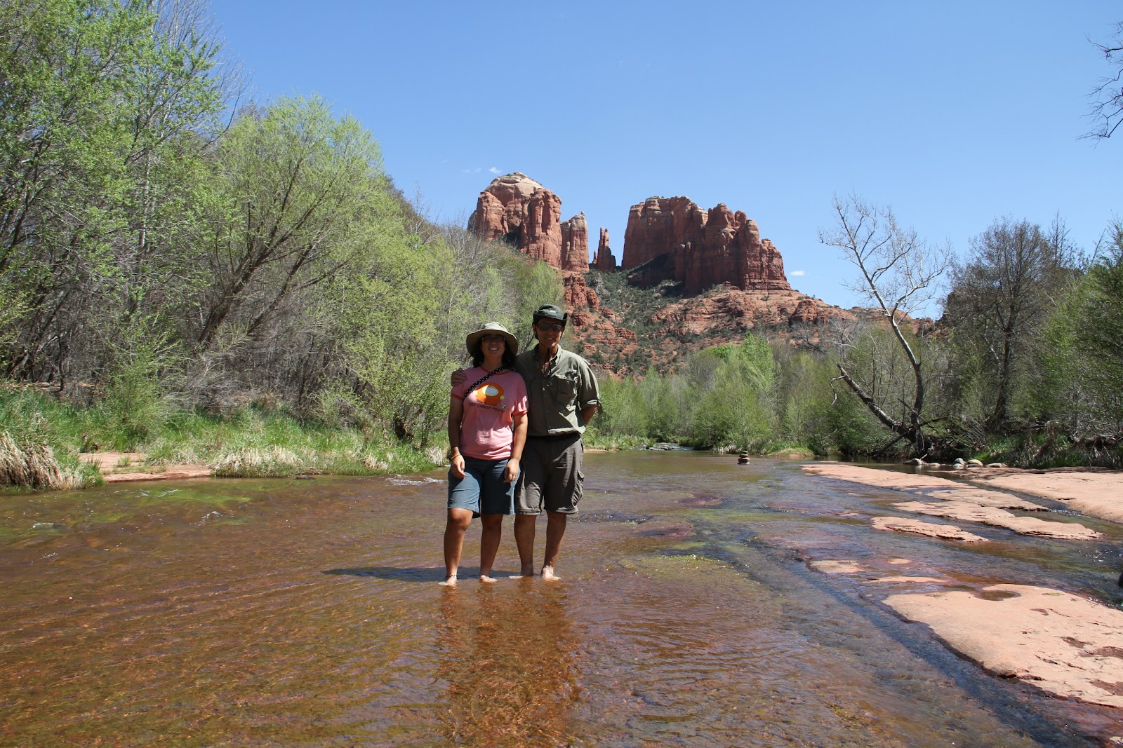
Sedona is home to Cathedral Rock, one of the most photographed sights in Arizona.
Cathedral Rock at Red Rock Crossings is the iconic photograph associated with Sedona. When I was preparing for this portion of the trip, researching Sedona and its sights, I came across this image many times...I had to go there as well.
A short clip of Cathedral Rock in the distance.
The core industry in Sedona is tourism. The Sedona Visitors Center receives more than 400,000 visitors per year. Sedona is ensconced by the 1.8 million-acre Coconino National Forest, which surrounds this city.
Even the family dog can't wait to frolic in the water.
The area around the parking lot was scenic, shaded and graced with picnic tables.
Would lunch be lunch without PB&J?
Oak Creek by Red Rock Crossingturned out to be a popular destination.
The beauty and vibe was so positive, people ignored the fact that the water was freezing.
There are some places that are too appealing for words. Okay, maybe if I was a poet, I could weave a phrase that captured the beauty...but I ain't no poet. On the other hand, if a picture=1000 words, then a short video clip even better:
We made our way towards Cathedral Rock along the water.
...just another reason to come back in an RV and hang out for awhile.
This is one of those places where I just can't put my camera away. In addition to its beauty, there was a special feeling from watching so many people enjoying the area in their own way. I'm just going to include a bunch of photos without narrative. It was a beautiful area and it just felt good to be here.
Florida tourists at Red Rock Crossing, below Cathedral Rock.
Lani came across a frog at the water's edge.
Oh yeah...gimme some warts.
This was the only frog we saw. It was well-photographed.
So, I'm laying on the ground with my Canon 7D in high-speed burst mode, ready to get an action photo sequence of the jumping frog. Result? In 0.1s, the frog was practically out of the scene.
I was looking for an area where Cathedral Rock reflected in the water, but couldn't find one.
It would be cool to come back when there's snow on Cathedral Rock.
Sedona is a popular destination for mountain bikers and hikers.
People stacked rocks like an outdoor Jenga championship.
I had absolutely no temptation to stack rocks.
Lani jumped right in.
Okay...the rock piles looked sorta cool.
Lani proudly demonstrates her finished rock pile.
One rock pile to rule them all.
I kept trying to do something artistic with the rocks.
One of the guys on his mountain bike parked it and decided to take advantage of a rope swing.
The water felt like it was 55°F when I walked barefoot through it
Before turning back, I shot one more video clip:
Heading back to the car, we stopped at the water wheel next to the parking lot.
Around 1930, new landowners in the area ordered a custom built water wheel from "back East". The water wheel drove a water pump and powered a small electric generator.
Just spending some time here was worth the effort to come to Sedona.
We returned to our campsite along Oak Creek and settled in for the evening.
The full moon was like a celestial spotlight over the camp grounds.