You should click on the scenic pictures. Trust me.
It was 383 scenic miles from Chico, CA to Eugene, Oregon. It was good to leave Chico.
I-5 in California starts in San Diego and heads north until farther than I had realized. I had never been been north of Sacramento but had heard that the most northern part of California was the most beautiful...and it was. Farm land gave way to rolling hills and mountains. Zipping along I-5 at 4mph above the the speed limit, we passed an exit sign for "Shasta Dam-1 mile". Guilt immediately set in and, at the next exit, I made a u-turn and headed back to the town of Shasta Lake, (or, confusingly enough, Lake Shasta), gateway to the Shasta Dam and Lake Shasta.
Immediately, the conversation between Lani and me devolved into dam jokes, as "Would you look at this damn town?" and, while standing in front of Lake Shasta, "heckuva dam." Followed by many more damn jokes.
 |
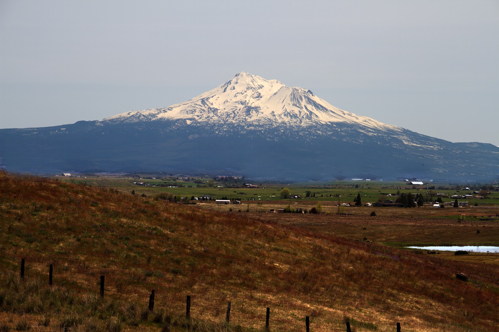
| A project of FDR's New Deal, the fading mining town of Kennett was sacrificed and lies some 400' below the surface. Popular for boating, water skiing, camping, house boating, and fishing, Lake Shasta is formed by the damming of the Sacramento River, Pit River, McCloud River and several smaller tributaries and has 365 mi of mostly steep mountainous shoreline. Snow-covered Mt. Shasta is in the distance. This is an eminently clickable panorama. |
Shasta Dam serves mainly to store winter floodwaters and release it during the summer and autumn months to maintain a steady flow in the Sacramento River, greatly facilitating irrigation and navigation on the entire lower stretch of the Sacramento, as well as inflow to the California Aqueduct while generating hydroelectricity.
 |
| The dam hasn't been all good. Underneath the waters of Shasta Lake lie buried the traditional lands of the Winnemem Wintu, one of nine groups of the larger Wintu ethnicity of northern California. The dam also damned the salmon run in the Sacramento River, leading the federal government to build the Coleman National Fish Hatchery. This is another eminently clickable panorama, but a little less eminent than the preceding one. |
Shasta Lake, or Shasta Lake City (pretty damned confusing), population 10164, is a tourist destination because of recreation on Shasta Lake (the lake, not the city.) In spite of the tourism, a recently constructed Starbucks had to close shortly after it opened.
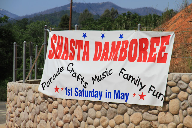 |
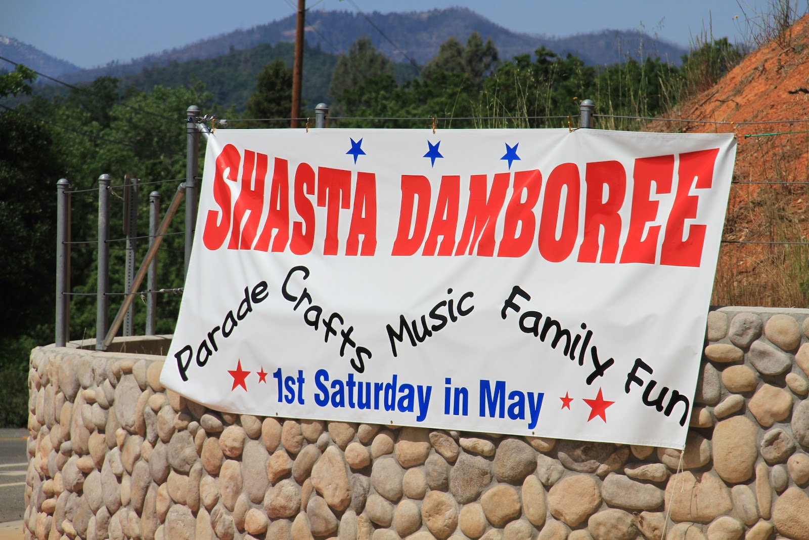
| We had just missed the Shasta Damboree, to which Lani exclaimed, "Damn, we missed the damboree!" |
Feeling that we had done our damnedest to explore Lake Shasta, Shasta Lake, Shasta Dam and the various permutations of "Lake" and "Shasta", with and without dam, we returned to I-5 and turned north.
 |
| 90 miles later, feeling hungry, we exited into Yreka, CA, population 7765, a town that dates to 1851 and the California Gold Rush. As for the Brickhouse Bakery & Pizzeria, the pizza was okay but the chocolate chip cookie I had for dessert? Damned disappointing. The downtown, however, was damned quaint and charming. |
Located at the southern end of the
Cascade Range and dominating the landscape for as much as 150 miles is
Mt. Shasta. The mountain consists of four overlapping volcanic cones which have built a complex shape, including the main summit and the prominent satellite cone of 12,330-foot
Shastina.
 |
| During the last 10,000 years Mount Shasta has erupted an average of every 800 years but in the past 4,500 years the volcano has erupted an average of every 600 years. The last significant eruption on Mount Shasta may have occurred 200 years ago. |
Continuing north on I-5 and passing through some beautiful areas of Southern Oregon, we exited into the town of Glendale for no specific reason except to check it out.
 |
| Population 855 with a total area of 0.4 square miles, the town disappears around the bend. |
The lumber mill between the interstate exit and the town seemed at least as big as the town itself.
 |
| Glendale started as a logging town and, I'm guessing, is the major employer. According to the 2000 census, 22% of the population lived below the poverty line. |
 |
| Yelp and Tripadvisor pointed us to Beppe & Gianni's Trattoria and a great Italian meal in a hip, friendly setting. We had a salad and split a main course. |
And, after a long day that included the Shasta Dam, Lake Shasta, Shasta Lake, Yreka, Glendale and, 380 miles later, Eugene, OR, we turned into the Traveler's Inn, a bargain at $52 and change.


Great photos!
ReplyDeleteThat Italian food sounds yummy!
Wow this is an awesome record of your trip! I hope you have a back up of everything. This is a treasure!
ReplyDelete-Shazia
Hi, Shazia,
ReplyDeleteThank you for looking and for your kind comments. The blog itself is backed up somewhere on a Google server. As for the photos, I can't recall if I had mentioned it to you, but the original high-resolution images were lost in a hard drive crash. I still have lower resolution images that are well-backed up.
Bob