It was 304 mostly rural and frequently scenic miles from Casper, Wyoming to Wall, South Dakota. This is the way we went.
As usual, the scenic photos are worth clicking on for a better look.
If I had been obsessed with making it to Yellowstone and Mammoth Hot Springs, Lani had been blathering non-stop about making it to the Badlands of South Dakota. The cycling part of the bike trip had been so long ago, but the car did gave us access to National Parks we (most people?) would never otherwise get to see...so, the Badlands it was. And, after that: back to the bikes.
Anyway, like Montana, Wyoming was spacious and sparsely populated.
 |
Another small town with a lot of local school pride. Edgerton, population 169,
like the rest of Wyoming - and like the surrounding states in the northern part of
the mid-west, is 96% white.. |
I could see two major features that provided for a living here: mines and the rail
 |
| A cavalacade of hopper cars make their way to an ore elevator, a simple enough looking scene yet one that defines the local economy and provides coal to the nation. Go Coal! |
I couldn't help but wonder how many people come this way and, if they do, what they notice on these remote roads? Settlement in this area, near Wright, Wyoming, begin in the 1970s with the creation of the Black Thunder Coal Mine, the largest mine in the Powder River Basin and most productive mine in the country.
Wright, WY was incorporated in 1985 and, in 2000, had a population of 1347. It is a mining town. I think it's safe to say that without the mining, there would not much to Wright.
 |
| I had to admire the simple elegance of bringing the rail to the ore, as well as the role of the rail in commerce and any local economy where the rail passes. The rail was a recurring theme when we were in Texas...it's everywhere. |
Did you know that Wyoming has been the largest source of coal for over 20 years? It turns out that we were passing through the Powder River Basin, a region so named because it is drained by the Powder River. This region supplies 40% of America's coal.
 |
| There were ginormous ore trucks on the adjacent mining roads. |
The area is home to the Black Thunder Coal Mine, one of the world's largest coal mines.
 |
| In 2007, the mine produced 86,196,275 short tons of coal, cranking out enough coal to load up 25 miles of railroad cars per day. |
The Black Thunder Coal Mine is operated by Arch Coal, owner/operator of several coal mines in America. We're talking billions of tons of coal reserves
 |
| I wonder if it's clean coal? |
Wyoming is the least populous state (barely 500,000, and, bonus!, 96% of them White) and has the second lowest population density, right behind Alaska. Leaving Wyoming gave us a chance to get the border crossing picture we missed when we entered the state.
 |
| The terrain change between Wyoming and South Dakota was so dramatic, you could practically tell that you had crossed a border just by looking at the local topography. Of all the pictures that I've taken on the trip, the border crossing photos are my favorite. Here, you're looking west into Wyoming. |
Entering South Dakota, we frolicked for almost 10 minutes at the border without seeing another vehicle. No surprise there as Montana, Wyoming and South Dakota are three of the least populous states in the country. 'matter of fact, these three states, while comprising about 8.5% of the land area of the U.S. have less than 1% of the population.
And, with the terrain change, we were within rolling forests, completely unlike Wyoming or Montana. South Dakota just looked different.
 |
| Lani had been jabbering about the Badlands of South Dakota ever since her own attempt solo attempt at a cross-country bike trip a couple of years ago. The state slogan "Great Faces, Great Places", should not be confused with the state motto "Under God, the People Rule." |
Entering South Dakota from its southwest border with Wyoming gave us access to the state's National Parks, National Forests and most famous scenic highlights.
 |
| Designated by Pres. Grover Cleveland as the Black Hills Forest Preserve in 1897, it was elevated to national forest status in 1907. The area probably has its name from the Lakota words Paha Sapa meaning "hills that are black". |
The park encompasses over 1.25 million acres and is predominantly ponderosa pine.
 |
| Proliferating herds of deer and elk inside the park have given way to increasing numbers of mountain lions. 30 campgrounds are located in the forest and there are 11 reservoirs that are well stocked for sport fishing. Next to the hokey poses at the state border crossings, I like the hokey poses in front of signs like these. |
Back on the road, which winded and dipped wildly in some areas, we were drawn to the sign for the Jewel Caves National Monument.
 |
| Discovered by two local prospectors in 1900 when they felt cold air blowing out of a small hole in a canyon, Jewel Cave National Monument is currently the 2nd longest cave in the known universe with >150 mapped miles. We hadn't planned on this and were both excited. Even Lani. |
As recently as 1959, less than two miles of the mine had been mapped. That changed when Herb and Jan Conn, local rock climbers, began exploring, and within two years had mapped 15 miles. The Park Service sunk a 300-foot shaft to a previously remote cave area, building concrete walks, metal stairs and platforms along a ½-mile loop. The "Scenic Tour" was opened in 1972.
 |
| 60 millions years ago, the Black Hills uplift created a network of cracks in the limestone. Gradual dissolution of the limestone left the caves behind. The walls of the cave became layered with calcite (a form of calcium carbonate) from water saturated the mineral. In the display is a large calcite crystal. |
The discovered areas in the cave account for only about 2% of the estimated total air volume of the cave, estimated by measuring the amount of air that the cave "exhales" when the outside air pressure drops and "inhales" when the outside air pressure rises.
 |
| Isn't this an overt form of discrimination on the basis of body habitus? Okay, I'm game, let's give it a try! Oh boy! |
First to assume the position was Lani.
 |
| I had some misgivings about shooting these photos of Lani, but I knew the slab would be on the other butt in a few minutes |
"Spelunking" and "spelunker", for "cave exploring" and "cave explorer" are now considered déclassé among experienced enthusiasts, preferring the expression "caving" and "caver". Cavers use the expression "spelunker" for the inexperienced, as in "Cavers rescue spelunkers".
 |
| I doubted whether Lani would make it. |
Because the areas in Jewel Cave that are now being mapped are so remote, cavers sometimes camp for as long as 4 days.
 |
| Looking up for help from her Dad. Sorry, honey...must take picture. |
To be perfectly honest, the thought of caving never appealed to me because of some issues with claustrophobia.
 |
| I figured if Lani could make it, I could...easily. That turned out not to be the case. |
Cave environments can be very fragile, from the crystal formations to the fauna. Serious cavers carry containers for securely storing/transporting urine and feces...presumably their own.
 |
| ...had to take off my jacket 'coz it quickly became clear I wasn't going anywhere otherwise. I think this is my least flattering photo in the blog, but had to include it out of fairness. |
Unfortunately, the next scheduled tour wasn't for another hour, so we - reluctantly - moved on.
 |
| I had to exhale - deeply - relax and push forward. |
Back on the highway, we aimed towards Custer, South Dakota and came across Four Mile, so-named because it was 4 miles from Custer on the Sidney Black Hills Stage Road.
 |
| Four Mile dates to 1876 and offers a self-guided walking tour. We...ummm..kept going. |
Four miles after Four Mile, we found ourselves in Custer, South Dakota, population 2607, dating to the late 1870s on land that the Oglala Sioux reluctantly ceded to the United States.
 |
| Looking a bit like a paint factory exploded upon it, The Purple Pie Place was highly rated on Yelp, Urbanspoon and TripAdvisor. |
The local Custer economy is based upon minerals, mining and tourism. Custer is the headquarters for the Supervisor of the Black Hills National Forest of South Dakota and Wyoming. Custer is a great base for exploring Jewel Cave National Monument, Wind Cave National Park, Custer State Park, and Mount Rushmore National Memorial. The Crazy Horse Memorial is located just north of the city.
 |
| Did you know that the leaves of the rhubarb plant are poisonous? My dad loved stewed rhubarb which my Mom made by the gallon, filling the freezer with bazillions of quart containers. I'm not much into pie. We had a decent meal. |
Custer and the Black Hills are popular for hunting and fishing. Wild turkey, deer and big game are popular hunting activities while brown, brook and rainbow trout are abundant in the streams and lakes.
 |
| Like many of the small towns we had visited, Custer had a nice feel. Custer claims to have the widest Main Street in the United States, made so in the 19th century for a team of oxen pulling a wagon to turn completely around. |
 |
| We had a boatload of books in the car that we'd have to ship back. |
I'm running out of things to say about Custer. Actually, I think I have. But, I'd come back and use it as a base to explore the surrounding areas
 |
| Lani carefully studying the 125,000 books in inventory. |
With excitement we turned towards the Crazy Horse Memorial, only to experience what was the biggest disappointment since leaving Gainesville two months ago. In progress since 1948 and supported only by donations, it is iffy that it will be completed ever. Your $10 dollar admission gets you into the Indian Museum of North America, and the Native American Cultural Center which, interestingly do not have Wikipedia entries...probably because of threat of lawsuit. Then, for an extra $4 per person, you can take a bus to the base of the nascent monument. Feeling ripped off and butt fully chafed, we moved on.
 |
| I took a picture from a mile away. The better part of me acknowledges that our entry fee for the museums will help fund the ongoing work of this visionary project. That's the better part of me...not this part. |
Less than 20 miles from Crazy Horse is Mt. Rushmore where we were eager to join the more than 2 million tourists who arrive each year. In spite of the multiple natural wonders within South Dakota, Mt. Rushmore is the state's most popular tourist destination.
 |
| On the approach to the park entrance was a Mountain Goat, determined to not let me get a close-up. I thought it looked pretty cool. I wasn't convinced that it was of this planet. |
From 1927 to 1941,
Gutzon Borglum and 400 workers sculpted the colossal 60' high carvings of presidents George Washington, Thomas Jefferson, Theodore Roosevelt, and Abraham Lincoln. representing the first 150 years of American history. In 1937, a bill was introduced in Congress to add the head of civil-rights leader
Susan B. Anthony, but an appropriations bill rider cut her funding. Ouch.
 |
| Wow...and I really mean it. It was thrilling just to stand here and gawk. I mean...it's real! |
The mall approaching the mountain is graced by the flags of each state.
 |
| And, as cool as it was, it got more cooler the more closer you got closer to it. [Please...no grammatical corrections; it was all just for emphasis.] |
The monument is a source of controversy among Native Americans because the United States seized the area from the Lakota tribe after the Great Sioux War of 1876. The Crazy Horse Memorial is a response to Mount Rushmore and is intended to be larger than Mount Rushmore. Having the support of Lakota chiefs; the Crazy Horse Memorial Foundation has rejected offers of federal funds.
 |
| Tourists from Gainesville, Florida at Mt. Rushmore. |
Borglum (the designer) selected Mount Rushmore as the site for several reasons, starting with the rock itself. The rock of the mountain is composed of smooth, fine-grained granite. The durable granite erodes only 1 inch every 10,000 years, indicating that it was sturdy enough to support sculpting.
 |
| Susan B. Anthony would have looked good with the men...even if she had not been a president. |
On our way out, we cross paths again with Oreamnos americanus, also known as the Rocky Mountain Goat, a large-hoofed mammal found only in North America.
 |
| Mountain goats are herbivores and spend most of their time grazing. Their diet includes grasses, herbs, sedges, ferns, moss, lichen, twigs and leaves from the low-growing shrubs and conifers of their high-altitude habitat. They are pretty rugged, able to withstand temperatures as low as −50 °F and winds of up to 100 mph. |
The entire construction cost came in at under a million dollars. And, more amazingly, no one died during construction.
 |
| On the road out of the area, I caught a different view of Washington and stopped for one more picture. |
It's funny how the incongruity of some sites leave you wondering, "Why...what is up with this?"
 |
| I looked...really, I did...and couldn't find anything about Madonna and why she was stuck in rural South Dakota. |
Madonna of the Prairie is not to be confused with Madonna of the Trail, a series of 12 monuments dedicated to the spirit of pioneer women in the United States. They were placed along the National Old Trails Road and extended from Bethesda, Maryland, to Upland, California, in each of the 12 states the road passed through.
 |
| Madonna is outstanding in her field. She reminded me of Christ of East Texas (see the first picture in the post) and had me wondering if the two knew each other. |
Passing near Rapid City, South Dakota, population 97956, meant that Lani held her breath until she turned indigo to induce me to stop at a used book store she identifed while Google-searching on my iPhone..a technological triumph when you stop to think about it.
 |
| Lani, in her bibliographic glory, in Rapid City, South Dakota. Go find something old, Lani. |
The Rapid City economy is based in government services, notably Ellsworth Air Force Base, home of the 28th Bomb Wing flying the B-1B long-range bomber. Various federal agencies including the National Park Service, US Forest Service, and Indian Health Service operate out of Rapid City.
 |
| It was a pretty massive selection of books. |
Leaving Rapid City, we turned towards the South Dakota Badlands. It was 55 rural miles from Rapid City to our day's destination at Wall, South Dakota. I don't think it was too long before Lani and I took note of the endless succession of billboards hawking Wall Drug.
 |
| The first of 50...no make that a 100...wait, it was probably more...I dunno...the first of a slew of signs beckoning the highway travel to go to Wall Drugs. |
We had probably passed a dozen, or two, before I commanded Lani to photograph them all.
 |
| Based solely on the billboards, future archaeologists will probably consider Wall Drug to be the most important building on the North American continent. |
Others have observed the multitude of signs for Wall Drug on I-90; try Googling "signs for Wall Drug".
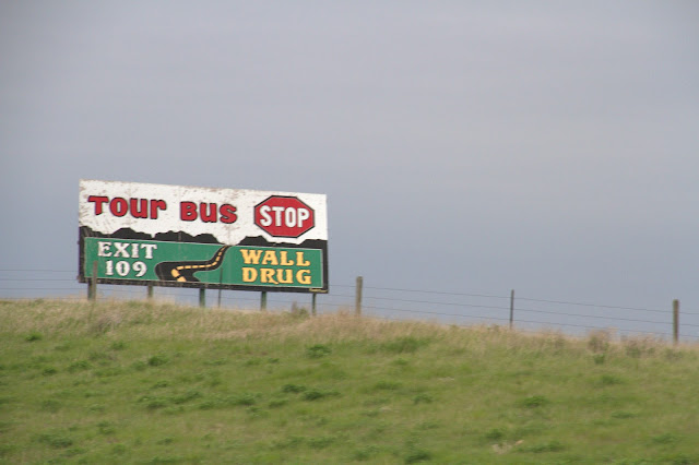 |
| A tour bus stopping at a drug store? Seriously? |
Apparently there are signs all around the world informing even the most profoundly disinterested as to how many miles it is to Wall Drug.
 |
| Well, that sounds like a nice gesture until you consider whether it is an act of friendship to offer someone a donut. |
Wall Drug got its start in 1931 when it was purchased by Ted Hustead, a Nebraska native and pharmacist who was looking for a small town with a Catholic church in which to establish his business. He bought Wall Drug, located in a 231-person town in what he referred to as "the middle of nowhere".
 |
| The town of Wall is small enough that Wall Drug is as much as a "tough to avoid" as it is a "must see." |
After Wall Drug opened, business was slow (how could it not be?) until Ted Hustead's wife, Dorothy, got the idea to advertise free ice water to weary travellers heading to the newly-opened Mount Rushmore, just 60 miles to the west...the rest is Wall Drug history.
 |
| Really taking liberties with the expression "Just Ahead." |
According to Wall folklore (and I know you know your Wall lore), when Ted returned from erecting the first sign, several cars were already in the lot. Today the annual Wall Drug billboard budget is over $300,000, representing several thousand signs.
 |
| The signs...they kept coming. |
I think it's safe to say that Wall Drug is part of Americana and, being Americans, we were sure as heck going to go there. Since I took the pictures, I'm just going to include a bunch of billboards for the sake of completeness.
Unavoidably, we eventually got there.
 |
| The excitement...is it not palpable? Are you irked by rhetorical questions? What if Bob were to ask you rhetorical questions in the 3rd person? Would that confuse you? |
By this time, we were waiting for each billboard with an unmitigated fervor...
 |
| Alright...maybe it was mitigated. |
You'd think - at least I would - that after seeing 50 billboards in the past 50 miles that one would need little reminder of what was coming.
 |
| "Last Chance...Next Exit" Will you remind me at least one more time? |
Wall Drug is the major retailer and only drug store in 6,000-square-mile area. And, you know what, even if you want for nothing, you're going to stop. If only because you gots to know. (
It's a "Dirty Harry" clip...you know the one...the punchline comes between 0:50 and the end.)
I have it on good authority that nearly 75 percent of the cars on I-90 are sucked into the Wall exit. That's 10,000 visitors per day, 20,000 in the summer, to a town of 800.
 |
| Hey...we're here! It's Wall! Let's find a cheap motel. Hey...anyone know a decent drugstore? |
Wall is spread over 2 square miles...I'm off the interstate and Wall Drug is only 3500' feet away. How many more signs have to be squoze in?
 |
| Actually, I do know some people who have an absolutely abysmal sense of direction and may need the guidance. |
Somewhere around here is a Super 8, our budget motel-of-choice.
 |
| During the summer after my first year of medical school, I held down two jobs. One was working as a waiter/bartender and the other was delivering lost luggage out of Newark International Airport. I covered the Great State of New Jersey, delivering recovered luggage, guided by fold-out maps. I can find Wall Drug. I know it. |
We dropped our luggage at the Super 8 and drove the ½-mile to the Wall downtown.
 |
| It was after 7pm and pretty much everything was closed. Including Wall Drug. Ironic...no? |
In rural areas, agricultural production is still very important to the state's economy. The tallest structure in Wall were the grain elevators that were just a few yards from Wall Drug and the Wall downtown.
 |
| You can't see it, but the grain elevators are right next to the railroad line. The rail is everywhere, even in the middle of nowhere. |
We took a little walk around the Wall downtown, looking for somewhere to eat. There was nothing!
 |
| I mean, it's sorta funny...bring your camera to a drug store? Seriously? Oh...it's a café, too? Sure. |
Wall, South Dakota, is just a few minutes from the Badlands, our destination for tomorrow. No surprise that stores and such would use "Badlands" in their name.
 |
| A family bar? It is the formerly wild West, so I guess it's okay. |
There was one touristy shop that was open. We were drawn in against our will. Okay...we willingly walked in.
 |
| Cool stuff...how do you put a value on steer horns? I was thinking of mounting a set of longhorns on my cycle handlebar, but came to my senses. |
TripAdvisor listed 7 restaurants in Wall with the Red Rock Restaurant listed as #1. We pulled in and found ourselves seated amongst locals...that felt nice The salad bar was grim, but the steak pretty decent. The white gravy on my potatoes was weak and had me wondering if I shouldn't have chosen a more flavorful color. In case you're in Wall, here's my review.
Tomorrow: the Badlands. Cautionary note: the weather forecast calls for gloom and clouds, much like today. Bad for photography...oh well.


No comments:
Post a Comment